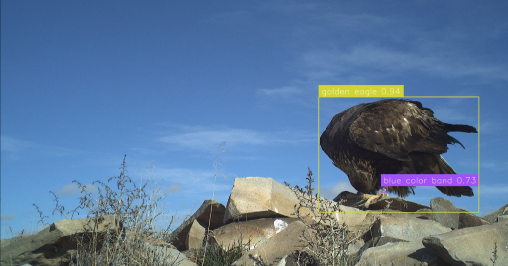
Black Harriers are Endangered. With an estimated 1,300 individuals1 left in the wild, they are one of the most scarce raptors in southern Africa. And it’s not just that; their population and the habitat they so closely rely on are declining. Black Harriers predominately breed in the Fynbos Biome2 of South Africa and have a strong preference for Renosterveld2 vegetation, a severely threatened ecosystem. Over 95% of Renosterveld vegetation has been irreversibly lost to agriculture, and much of the remaining vegetation is fragmented and overgrazed.
While pockets of suitable breeding habitat remain protected, a more recent threat has emerged over the past five years—wind energy. South Africa has an energy crisis, with demand outweighing supply. The wind energy market is emerging as a much-needed competitive supplier of renewable energy. Since the first commercial wind farm became operational in the country in 2014, nearly 1,500 turbines have been built. Although this is contributing to filling the energy gap, it has created a new obstacle in the landscape for raptors to navigate. For Black Harriers, the impact is grim. Over the past five years, at least 11 Black Harriers have been killed by collisions with wind turbines, and the significance of this is not lost; modeling has shown that if three to five harriers are killed per year by turbines (or any other source beyond expected natural mortality), then the population will collapse within 75 to 100 years1.
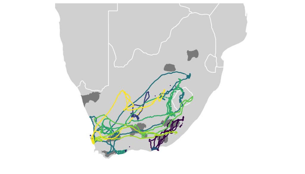
So what can we do? In 2021, in collaboration with the FitzPatrick Institute of African Ornithology, HawkWatch International started to fit Black Harriers with lightweight GPS tags in order to understand their movements and what puts them at risk of collisions with turbines. We have deployed 12 GPS tags so far and are continuing to deploy more tags this season. Although Black Harriers breed in southwestern fynbos regions of the country, they migrate outside of the breeding season, taking long journeys inland (see map).
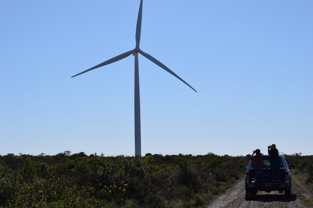
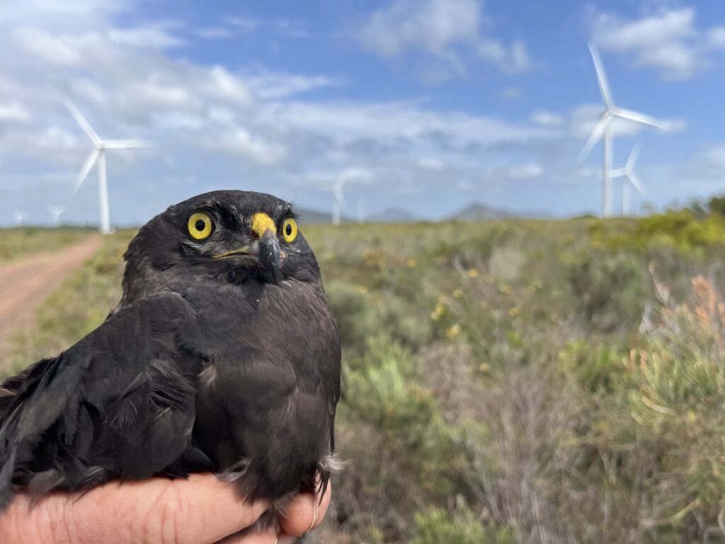
In early October, I headed up to Jeffreys Bay to meet Jessie Walton, who has been monitoring harriers in the area for the past 12 years. Jessie had found a pair nesting inside an operational windfarm, and our task was to deploy transmitters on them. Jeffreys Bay Wind Farm consists of 60 turbines and was amongst the first to become operational in the country. Unfortunately, this site has already sustained multiple Black Harrier collisions. Since harriers typically fly close to the ground, this impact was not expected in the early development of wind energy in the country. Now evident as a problem, Jeffreys Bay Wind Farm is committed to tracking breeding harriers to understand and mitigate this risk.
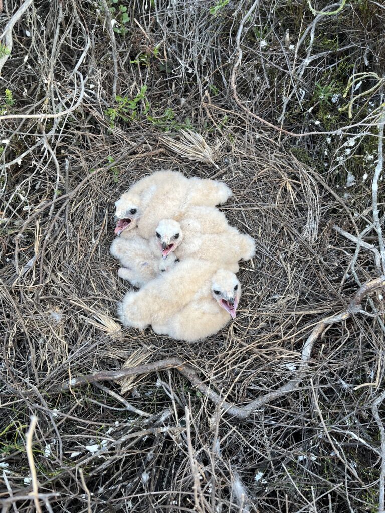
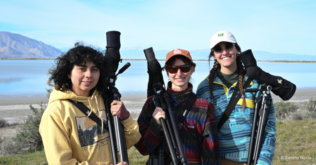
Harriers nest on the ground, so it can take time and careful observation to work out exactly where the nest is. With the help of Sanjo Rose (the newest addition to the HawkWatch team) and Jessie’s colleague, Jackie Huber, we spent the morning watching the harriers and recording their behaviour to narrow down the nest location. We were thrilled to find a large healthy brood of four chicks.
Next up, we wanted to deploy GPS tags on the adults. The weather was against us, with rain and strong winds forecast; we only had a small window to work, but we were fortunate to manage to trap both adults and fit the tags. Male harriers are smaller than females, so he was fitted with a 6g tag, while the female was fitted a 10g tag. Both tags are capable of sending us locations every around every ±15 minutes, depending on the solar charge. This season, the tracking data will help to inform observer-led shutdown on demand, whereby turbines can be switched off if a harrier is flying in the vicinity, hopefully safeguarding the adults and their four chicks.
Mitigating raptor collisions is a major priority for conservationists and wind energy developers in South Africa. While the industry is growing rapidly, we are working together to find solutions. Collision risk is species-specific, and therefore, not all mitigation methods will work for all species. The GPS tracking data can give us detailed information on what puts this Endangered species at risk and what we can do to minimise this risk.
Looking for a way to help support this work? You can sponsor a transmitter that we use to track Black Harriers. You will receive a one-time physical package including items such as a certificate, a photo of a Black Harrier, a fact sheet, and more, as well as quarterly impacts on your bird. Click here to sponsor: https://hawkwatch.org/transmitters/
1. Cervantes, F., Martins, M. & Simmons, R. E. Population viability assessment of an Endangered raptor using detection / non-detection data reveals susceptibility to anthropogenic impacts. R. Soc. Open Sci. (2022).
2. The Fynbos biome is unique to South Africa. It occupies a small area of the country (<6%) but it is characterised by extremely high plant species richness and endemism. Two main vegetation types within the biome are Fynbos (dominated by ericas, restios, and proteas) and Rhenosterveld (dominated by members of the daisy family, including Rhenosterbos, and grasses). Rhenosterveld occurs in more fertile areas, which has driven the extensive conversion for agriculture. Source and more info: https://pza.sanbi.org/vegetation/fynbos-biome
This blog was written by Dr. Megan Murgatroyd, HWI’s Associate Director of African Programs. You can learn more about Meg here. Photos also by Meg Murgatroyd.